Sava
Longest tributary of the Danube, flowing through four countries.

Petar Milošević · CC BY-SA 4.0
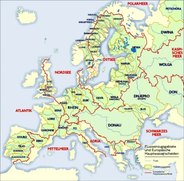
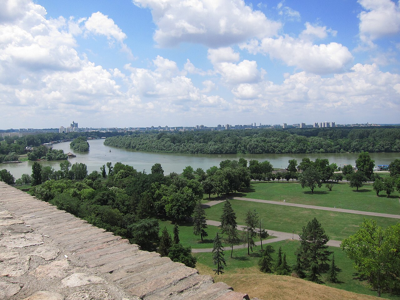
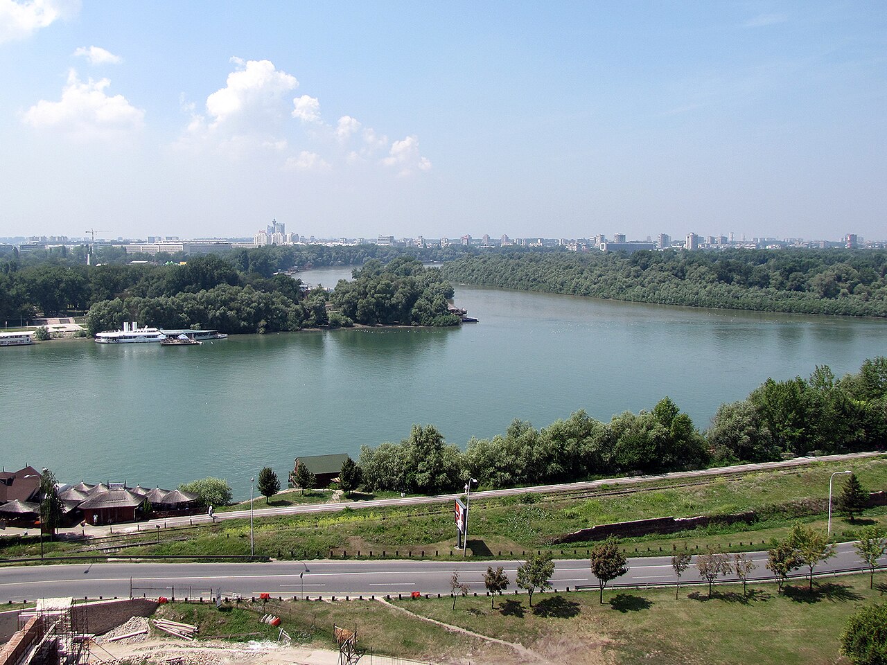
The Sava is a river in Central and Southeast Europe, a right-bank and the longest tributary of the Danube. The river flows through Slovenia, Croatia, and along the border of Bosnia and Herzegovina, before reaching Serbia and feeding into the Danube in Belgrade.
- source
- Zelenci Pools near Kranjska Gora, Slovenia
- mouth
- Danube River, Belgrade, Serbia
- navigable_from
- Sisak, Croatia (confluence of Kupa)
- capital_cities_on_basin
- Ljubljana, Zagreb, Belgrade
Lore & Background
The Sava is formed from the Sava Dolinka and Sava Bohinjka headwaters in northwest Slovenia. The Sava Dolinka rises at the Zelenci Pools near Kranjska Gora, fed by groundwater, and is considered the river's initial 45-kilometre segment. The Sava Bohinjka originates at the confluence of the Jezernica and Mostnica rivers, with some sources including the Savica Falls as part of its course. Downstream from Radovljica, the two headwaters merge to form the Sava proper. The river flows through the capital of Slovenia, Ljubljana, then through the Sava Hills and past towns such as Litija, Trbovlje, and Krško, where the Krško Nuclear Power Plant uses its water. It then becomes a border river between Slovenia and Croatia near the Sutla confluence. In Croatia, the Sava passes through Zagreb and continues to Sisak, the westernmost point navigable for larger vessels. East of Sisak, the river forms the border between Croatia and Bosnia-Herzegovina, meandering past towns like Gradiška, Slavonski Brod, and Brčko before reaching the Drina confluence. The name Sava is believed to derive from a Proto-Indo-European root meaning 'to press, push forth; to take liquid, water,' literally 'that which waters [the ground].' The ancient Greeks called it Saos, and the Romans used Savus. Strabo also used the name Noarus for the river in its entirety or its lower part.
Reader's Guide
The Sava River is significant as the longest tributary of the Danube and the largest by volume of water, draining a substantial portion of the Dinaric Alps region. The river's course is sometimes used to describe the northern boundary of the Balkans and the southern border of Central Europe. The Sava is about two-thirds navigable for larger vessels, from the confluence of the Kupa in Sisak downstream. However, navigation conditions are poor due to limited draft, meandering, bridge clearance restrictions, and hazards such as unexploded ordnance from various conflicts. Its tributaries include the Drina, Bosna, Kupa, Una, Vrbas, Lonja, Kolubara, Bosut, and Krka. The river's headwaters in Slovenia feature the Savica Falls, a 78-metre waterfall flowing from the southern flank of Triglav.
Did You Know?
- The Sava is the largest tributary of the Danube by volume of water.
- The river's name is believed to derive from a Proto-Indo-European root meaning 'that which waters [the ground].'
- The Sava is about two-thirds navigable for larger vessels, starting from the confluence of the Kupa in Sisak.
- The river's basin includes three capital cities: Ljubljana, Zagreb, and Belgrade.
Geography & Course
The Sava stretches 990 kilometres from its Slovenian headwaters to its mouth in Belgrade, where it meets the Danube as a right-bank tributary. This makes it one of the longest rivers on the European continent and, by discharge, the single largest contributor of water to the Danube system. Its catchment spans roughly 97,700 square kilometres, ranking second only to the Tisza among Danube tributaries in both area and length. The river threads through Slovenia, Croatia, and Serbia while tracing the border with Bosnia and Herzegovina, and it belongs to the Black Sea drainage basin. Geographers have long used its course as a rough dividing line: the northern edge of the Balkans and the southern fringe of Central Europe. Before Yugoslavia dissolved in 1991, the Sava held the distinction of being the longest river lying entirely within a single country. Even excluding its 45-kilometre Sava Dolinka headwater, the main stem at 945 kilometres still places it just behind the Tisza and the Prut as the Danube's third-longest tributary.
Sources & Headwaters
The Sava is born from the meeting of two headwater streams in the northwest corner of Slovenia. The Sava Dolinka springs from the Zelenci Pools near Kranjska Gora, at an elevation of 833 metres, in a valley that separates the Julian Alps from the Karawanks. This source sits in a drainage divide between the Adriatic and Danube basins, close to the Slovenian-Italian border, and is fed by groundwater that may represent a bifurcation of a karst aquifer shared with the Soča basin. A small losing stream called Nadiža creek supplies the pools themselves. The other headwater, the Sava Bohinjka, begins at Ribčev Laz where the Jezernica, flowing out of Lake Bohinj, joins the Mostnica. Some accounts trace this branch further upstream to the Savica, which tumbles 78 metres from the southern flank of Triglav before feeding the lake. The Bohinjka travels 41 kilometres eastward to Radovljica, where it meets the Dolinka; from that confluence the combined flow is simply called the Sava. Additional smaller tributaries such as the Sora, Tržič Bistrica, and Radovna join the river at confluences as far downstream as Medvode.
Basin & Human Geography
The Sava basin is home to an estimated 8.18 million people and passes through or near three national capitals: Ljubljana, Zagreb, and Belgrade. The river drains a large swath of the Dinaric Alps, receiving water from major tributaries including the Drina, Bosna, Kupa, Una, Vrbas, Lonja, Kolubara, Bosut, and Krka. Roughly two-thirds of the Sava is navigable by larger vessels, with the practical limit for big shipping beginning at the Kupa confluence in Sisak, just below Zagreb. In Slovenia the river has been heavily harnessed for energy: hydroelectric plants at Moste, Mavčiče, Medvode, and Vrhovo line its course, and the Krško Nuclear Power Plant draws Sava water to cool its reactors. Mining and industrial towns such as Litija, Zagorje ob Savi, Trbovlje, and Hrastnik grew up along its banks in the Sava Hills and Central Sava Valley. In Ljubljana, a reservoir on the river sits beside the Tacen Whitewater Course, linking the Sava to recreational sport. The river's Slovenian stretch runs 221 kilometres before it becomes a border water with Croatia near the Sutla confluence.
Etymology & Historical Identity
The name Sava reaches back to Proto-Indo-European, where the root *sewh1- carried the sense of pressing or pushing forth, or drawing out liquid, and the suffix *eh2 turned it into a noun. The literal meaning is 'that which waters the ground,' a fitting description for a river that sustains millions. The ancient Greeks knew it as Saos, and the geographer Strabo, writing his Geographica between 20 BC and AD 20, recorded the form Saüs. Roman writers used Savus. Strabo also applied the name Noarus to the Sava either in its entirety or specifically to its lower reaches, giving the river an extra layer of classical identity. Historically, the Sava's course has served as a political and cultural boundary: it marks the northern edge of the Balkans and the southern limit of Central Europe. Before the 1991 breakup of Yugoslavia, the river was the longest watercourse lying wholly within that single state, a fact that underscored its centrality to the region's geography and identity well before modern borders redrew the map.
Gallery
Frequently Asked Questions
Where does Sava's story begin?
Sava takes its first breath at the Zelenci Pools near Kranjska Gora in Slovenia, fed by the Sava Dolinka headwater stream. From that alpine starting point it embarks on a journey that will cross four sovereign nations.
Which countries does Sava travel through?
Sava flows through Slovenia and Croatia, traces the border of Bosnia and Herzegovina, and finally enters Serbia. It becomes navigable from Sisak in Croatia, the point where the Kupa joins it.
More in Rivers Of Europe 1-19
Spotted an error? Know more?
This is a living reference — every entry is fact-audited, and reader corrections feed straight into our audit queue. Suggest an edit · See this site's audit record