Neva
River in northwestern Russia, fourth-largest in Europe by discharge.

Deror_avi · CC BY-SA 4.0
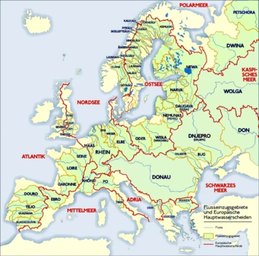
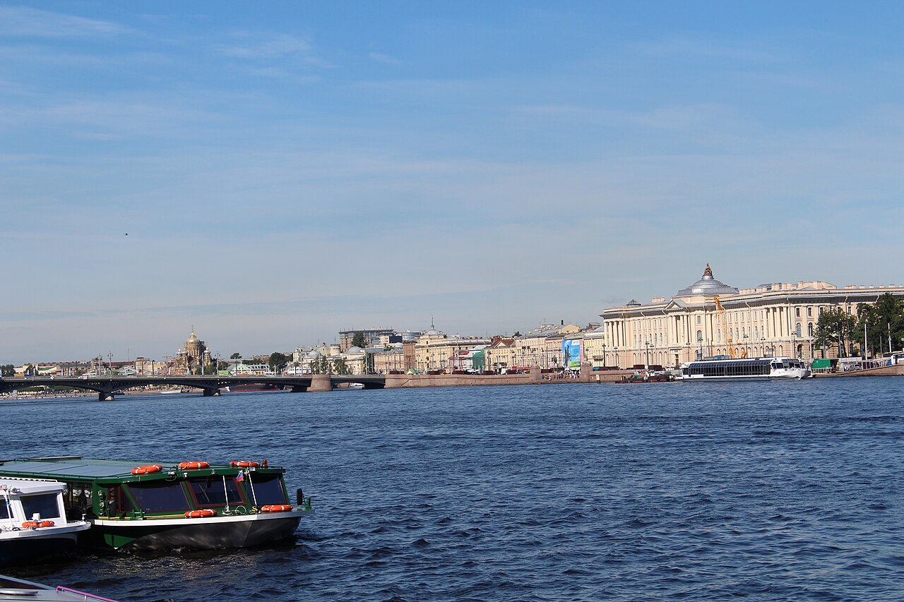
The Neva is a river in northwestern Russia, flowing from Lake Ladoga through Leningrad Oblast to the Neva Bay of the Gulf of Finland. Despite its modest length of 74 kilometers, it is the fourth-largest river in Europe by average discharge, after the Volga, the Danube, and the Rhine. It is the only river flowing from Lake Ladoga and passes through the city of Saint Petersburg, as well as the towns of Shlisselburg, Kirovsk, and Otradnoye.
- length
- 74 km (46 mi)
- source
- Lake Ladoga
- mouth
- Neva Bay, Gulf of Finland
- average_discharge
- 2,500 m³/s (88,000 cu ft/s)
- navigable
- Throughout; part of Volga–Baltic Waterway and White Sea–Baltic Canal
Lore & Background
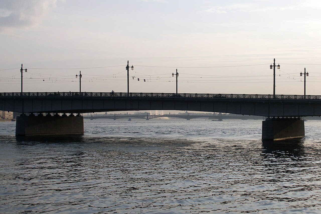
The Neva flows out of Lake Ladoga near Shlisselburg and discharges into the Baltic Sea. Its banks are low and steep, averaging 3 to 6 meters in height. The river has three sharp turns, including at the Ivanovskye rapids, where the narrowest point (210 meters) occurs. The average width is 400 to 600 meters, and the average depth is 8 to 11 meters, with a maximum of 24 meters above the Liteyny Bridge. The river declines 4.27 meters in elevation from source to mouth.
Reader's Guide
The river is navigable throughout and forms part of the Volga–Baltic Waterway and White Sea–Baltic Canal. Its delta, technically a pseudodelta, was formed by scouring past sediments rather than accumulation. The river freezes from early December to early April, with ice thickness varying from 0.3 to 0.6 meters. Floods in Saint Petersburg are usually caused by overflow, though the river has almost no spring floods due to uniform water flow from Lake Ladoga.
Did You Know?
- The Neva is the only river flowing from Lake Ladoga.
- Its name may derive from Finnic words meaning 'poor fen,' 'watercourse,' or 'waterway,' or from an Indo-European adjective meaning 'new.'
- The Ivanovskye rapids, the narrowest part of the river, were created by a breakthrough of the Mga valley into the Tosna/lower-Neva valley.
The River That Was Born in a Flood
The Neva is, by geological standards, a remarkably young waterway. Three to four hundred million years ago the entire delta region lay beneath a shallow sea. The landscape we recognize today was carved by retreating glaciers, which left behind the Littorina Sea—its surface sitting seven to nine metres above the modern Baltic. During that era the Tosna drained into Litorinal waters through what is now the lower Neva corridor, while the Mga flowed eastward into Lake Ladoga. The two basins were entirely separate. The transformation came through glacial rebound. As land near Lake Ladoga rose faster than surrounding terrain, a closed endorheic lake briefly pooled in the Mga valley. When that water overspilled, it tore a path westward into the Tosna and lower-Neva valley, and the Ivanovskye rapids were born at the breakthrough point. Early sources placed this event around 2000 BC, but more recent research narrows the window to roughly 1410 to 1250 BC. The resulting delta is technically a pseudodelta: rather than being built from sediment the river deposits, it was sculpted by the scouring of older glacial and post-glacial deposits. The valley has changed very little in the two and a half millennia since that breakthrough.
A Modest Length, an Enormous Voice
Despite spanning only 74 kilometres from its source near Shlisselburg to its mouth in the Gulf of Finland, the Neva ranks as the fourth-largest river in Europe by average annual discharge, trailing only the Volga, the Danube, and the Rhine. Its average flow of 2,500 cubic metres per second is made possible because it is the sole outlet for Lake Ladoga, receiving a steady year-round supply that largely prevents the spring flooding common to many other rivers. Physically, the river is a study in contrasts. Its banks are low and steep, averaging three to six metres in height, yet the channel is broad—400 to 600 metres on average, widening to over a kilometre in the delta. The total elevation drop from source to mouth is a mere 4.27 metres, yet the river still produces the Ivanovskye rapids where it crosses a moraine ridge, narrowing to just 210 metres. Depths range from 4 to 4.5 metres in the rapids to a maximum of 24 metres above the Liteyny Bridge. The Neva freezes solid from early December through early April, and summer water temperatures hover between 17 and 20 degrees Celsius, granting a swimming season of barely six weeks.
A Waterway Written in History
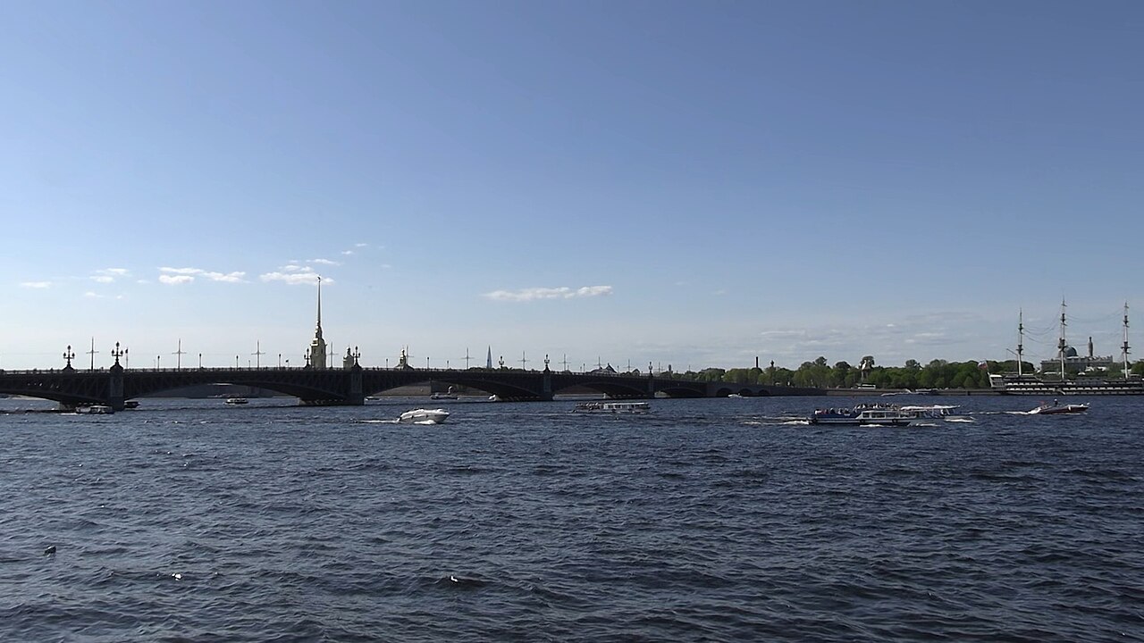
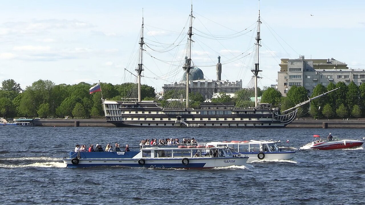
The Neva has served as a stage for some of the most consequential events in European history. In 1240, the Battle of the Neva took place on its waters, a conflict that gave Alexander Nevsky his name. Centuries later, in 1703, the river's delta became the site of the founding of Saint Petersburg, built on its low, swampy banks. The river also witnessed the Siege of Leningrad during World War II, when the German army encircled the city. Long before these events, the Neva was a vital artery of trade linking Byzantium and Scandinavia, threading through a landscape inhabited by Finnic peoples whose languages still carry the river's name. In Finnish the word means "poor fen," in Karelian "watercourse," and in Estonian (as nõva) "waterway." Some scholars have suggested the name derives from an Indo-European root meaning "new," a fitting description given the river's relatively recent geological birth. The river remains fully navigable today and forms part of both the Volga–Baltic Waterway and the White Sea–Baltic Canal, threading through Saint Petersburg and the smaller towns of Shlisselburg, Kirovsk, and Otradnoye.
The Basin and the City That Shaped It
Beyond its 74-kilometre course, the Neva anchors one of the most complex hydrological networks in northern Europe. Its basin area is 5,000 square kilometres, but when the pools of Lake Ladoga and Lake Onega are included, the total drainage area stretches to 281,000 square kilometres. Within that vast system lie 26,300 lakes and a web of more than 48,300 rivers, though only 26 flow directly into the Neva itself. The principal tributaries on the left bank include the Mga, Tosna, Izhora, Slavyanka, and Murzinka, while the Okhta and Chyornaya Rechka join from the right. The human hand has reshaped this network profoundly. When Saint Petersburg was founded in 1703, the surrounding terrain was low and swampy, demanding the construction of canals and ponds for drainage. The earth excavated during that work was repurposed to raise the city above the waterline. In this way, the river's immediate landscape became inseparable from the engineering ambitions of the city that grew along its banks, and the hydrological character of the delta has been continuously altered through the city's entire history.
Gallery
Frequently Asked Questions
What is the Neva?
The Neva is a river in northwestern Russia that serves as the sole outflow of Lake Ladoga, carrying its waters through Leningrad Oblast and into the Neva Bay of the Gulf of Finland.
How long is the Neva, and why does its length matter?
At just 74 kilometres, it is remarkably short, yet it still ranks as Europe's fourth-largest river by average discharge—behind only the Volga, Danube, and Rhine. Its enormous flow comes from funneling all of Lake Ladoga's outflow through a single, compact channel.
What is the Neva's average discharge?
The river moves roughly 2,500 cubic metres of water per second on average, a volume that makes it one of the most powerful rivers on the continent despite its modest length.
Which cities and towns does the Neva flow through?
Its course passes through Shlisselburg, Kirovsk, and Otradnoye before threading the heart of Saint Petersburg, where it has shaped the city's identity for centuries.
How does the Neva fit into Russia's inland waterway network?
It is a key segment of both the Volga–Baltic Waterway and the White Sea–Baltic Canal, effectively linking the country's vast inland river systems to the Baltic Sea.
More in Rivers Of Europe 1-19
Spotted an error? Know more?
This is a living reference — every entry is fact-audited, and reader corrections feed straight into our audit queue. Suggest an edit · See this site's audit record